 ar
ar bg
bg hr
hr cs
cs da
da nl
nl fi
fi fr
fr de
de el
el hi
hi it
it ko
ko no
no pl
pl pt
pt ro
ro ru
ru es
es sv
sv tl
tl iw
iw id
id lv
lv lt
lt sr
sr sk
sk sl
sl uk
uk vi
vi et
et hu
hu th
th tr
tr fa
fa ms
ms hy
hy ka
ka ur
ur bn
bn mn
mn ta
ta kk
kk uz
uz ku
ku
gauge water level
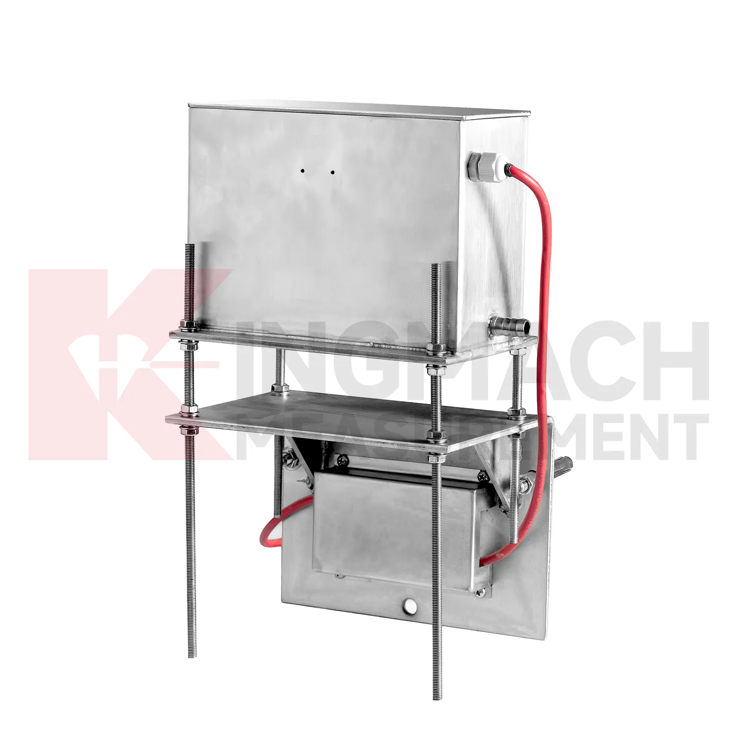
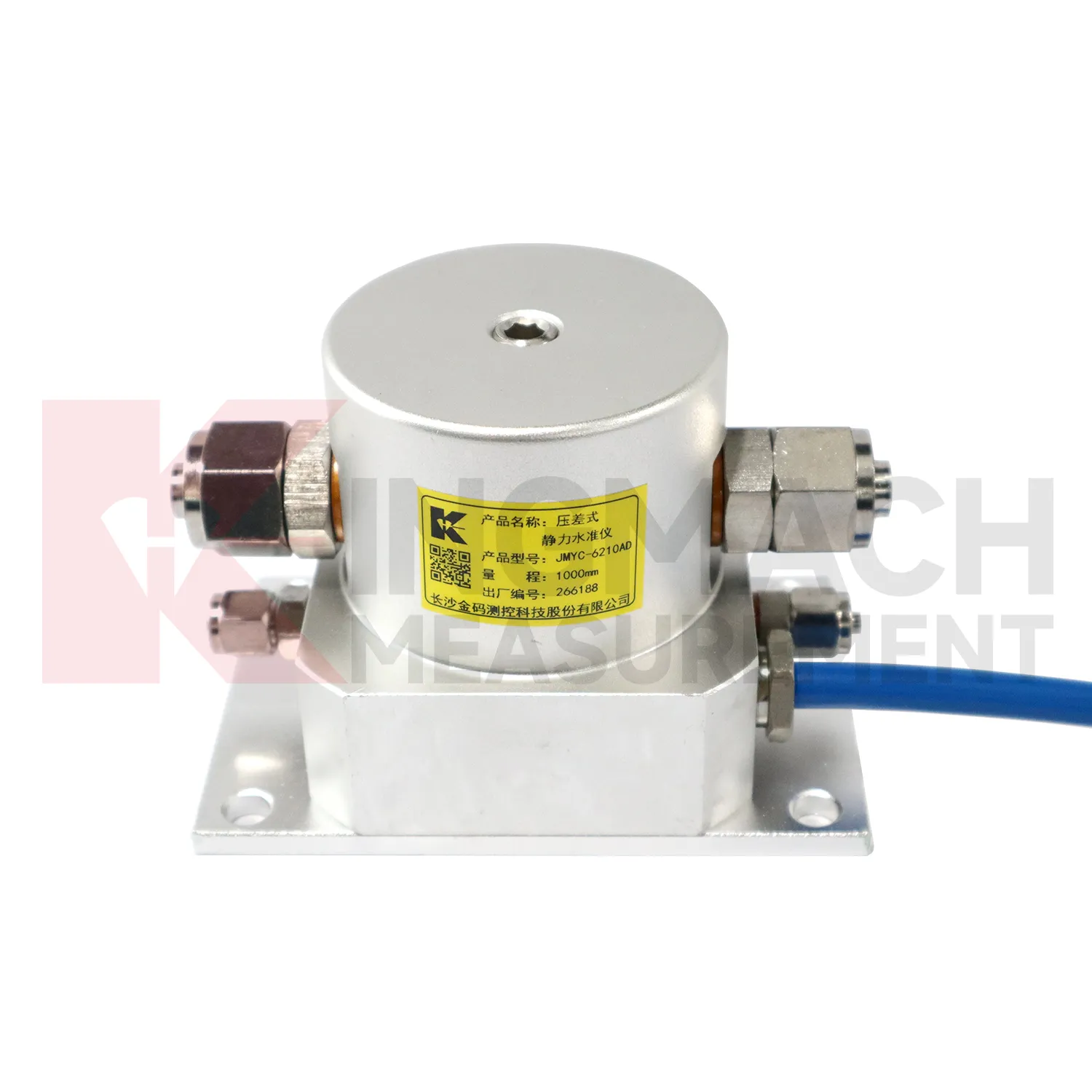
Kingmach gauge water level include the JMDL-62XXADT inductive frequency-modulated hydrostatic level sensor for projects that need a hydrostatic reference network rather than isolated manual checks. The instrument is arranged with connecting tubes, so each measuring location works against a shared liquid level and a stable reference point. Listed ranges are 50 mm, 100 mm, and 200 mm, with 0.01 mm resolution, 0.5%FS accuracy, RS485 output, DC 9V to 24V supply, power consumption below 0.5W, and an operating temperature from -30 degrees Celsius to +80 degrees Celsius. It is applied in dam deformation observation, bridge deflection, slope stability, building settlement, and high-speed rail foundation monitoring. A good project layout starts with the reference benchmark, tube slope, exhaust position, cabinet height, cable route, and channel address. During commissioning, the crew should remove trapped air, confirm fluid continuity, record the initial level, and compare every channel under the same temperature condition. The data cabinet can then collect each channel by address and preserve a clear relation between tube branch, instrument serial number, and drawing location. This makes later data easier to judge because a curve change can be traced back to a named measuring point, a known hydraulic path, and a documented baseline.
Application of gauge water level
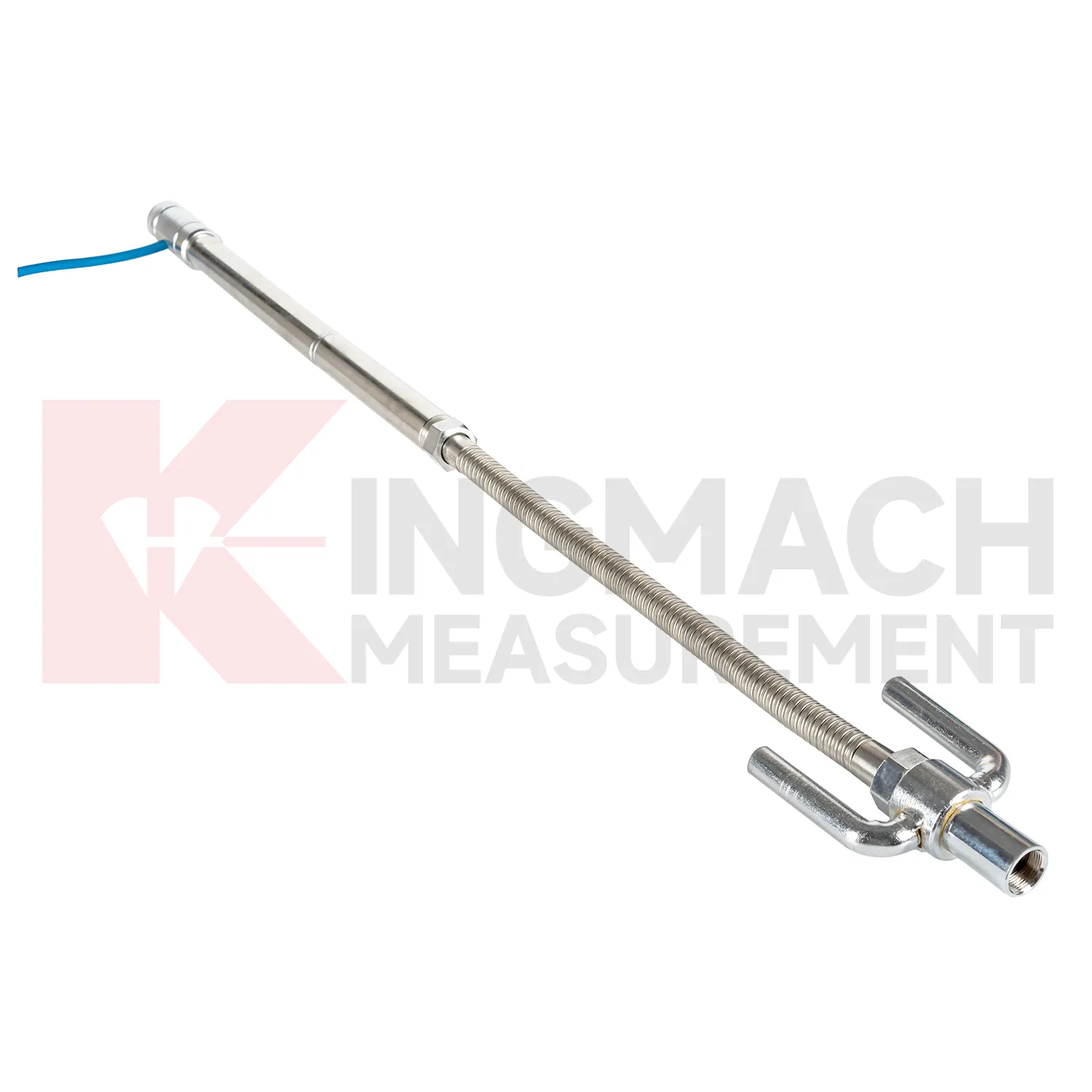
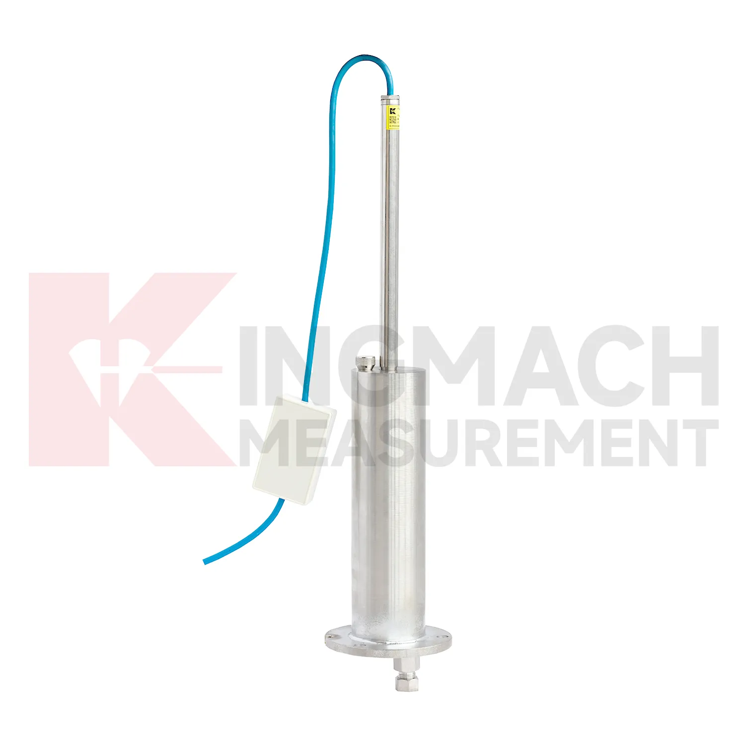
In bridge deflection and pier foundation monitoring, gauge water level help engineers follow vertical behavior that may change with traffic, temperature, bearing response, scour, or foundation compression. Kingmach JMQJ-62XXADT micro range hydrostatic level sensors provide 50 mm and 100 mm ranges, 0.01 mm resolution, RS485 output, and IP68 protection for small movements near decks, piers, or abutments. JMDL-62XXADT hydrostatic sensors can connect several measuring points through tubes, allowing a bridge team to compare related locations against a common reference instead of reading each point alone. A practical layout may place sensors near pier caps, bearing seats, approach slabs, or foundation observation positions, depending on the risk being tracked. The daily review should not look at the settlement curve by itself. Traffic loading, temperature swing, inspection findings, bearing condition, river level, and nearby structural instruments give the curve meaning. If a pier point drifts while the deck and approach slab stay stable, the cause is different from a whole-span temperature response. Clear naming, stable reference control, and consistent reading intervals turn small vertical changes into usable maintenance evidence.
The future of gauge water level
Future gauge water level will make long-term maintenance analytics more practical. Settlement records are often slow, which means the useful signal may appear over months instead of days. Platforms can compare cumulative settlement, daily rate, seasonal pattern, rainfall, groundwater, traffic loading, filling stage, and excavation history. Kingmach products such as JMYC-62XXAD and JMDL-47XXAT can support this longer view when the baseline and reference point remain stable. Owners will benefit from reports that separate normal consolidation from renewed deformation after new construction, water-level change, or heavy traffic. This is especially important for roadbeds, bridges, buildings, dykes, dams, and reclamation foundations where movement may continue after handover. Future reports should show rate changes, dormant periods, and renewed activity in a way maintenance teams can compare across many assets.
Care & Maintenance of gauge water level
Trend review for gauge water level should include the surrounding engineering story. Settlement may respond to filling height, excavation depth, dewatering, rainfall, groundwater, reservoir level, traffic loading, concrete curing, or nearby construction. A sudden change may be real, but it may also come from disturbed tubes, moved reference points, loose cables, weak batteries, or manual reading error. Compare each curve with nearby displacement, tilt, strain, load, pore pressure, and water level data when available. For long-term projects, review rate of change as well as total settlement. A small value that keeps accelerating may matter more than a larger value that has stabilized. Maintenance staff should flag date, likely trigger, nearby work, inspection result, and follow-up action in the same record. That habit makes the curve useful during design review, safety meetings, and later handover.
Kingmach gauge water level
For dams and water-related structures, gauge water level must be read together with hydraulic conditions. Dam settlement, bridge deflection near water, dyke compression, and foundation deformation may respond to reservoir level, seepage, rainfall, temperature, and seasonal operation. Kingmach JMQJ-62XXADT and JMDL-62XXADT hydrostatic sensors can support multi-point vertical deformation monitoring, while JMCJ-1003/1005 can add groundwater level and layered settlement information. The field record should identify reference point, tube layout, cabinet position, water level, and inspection date. A reading after heavy rain has a different meaning from the same reading during a dry operating period. Settlement data becomes stronger when it is tied to the water story around the structure. The practical aim is a traceable vertical movement history that can support construction control, maintenance planning, and risk review without rewriting the site story. The practical aim is a traceable vertical movement history that can support construction control, maintenance planning, and risk review without rewriting the site story.
FAQ
Q: What is JMCJ-1003/1005 used for?
A: It is used to measure layered underground settlement and groundwater level in foundations, subgrades, foundation pits, embankments, and underground structures.
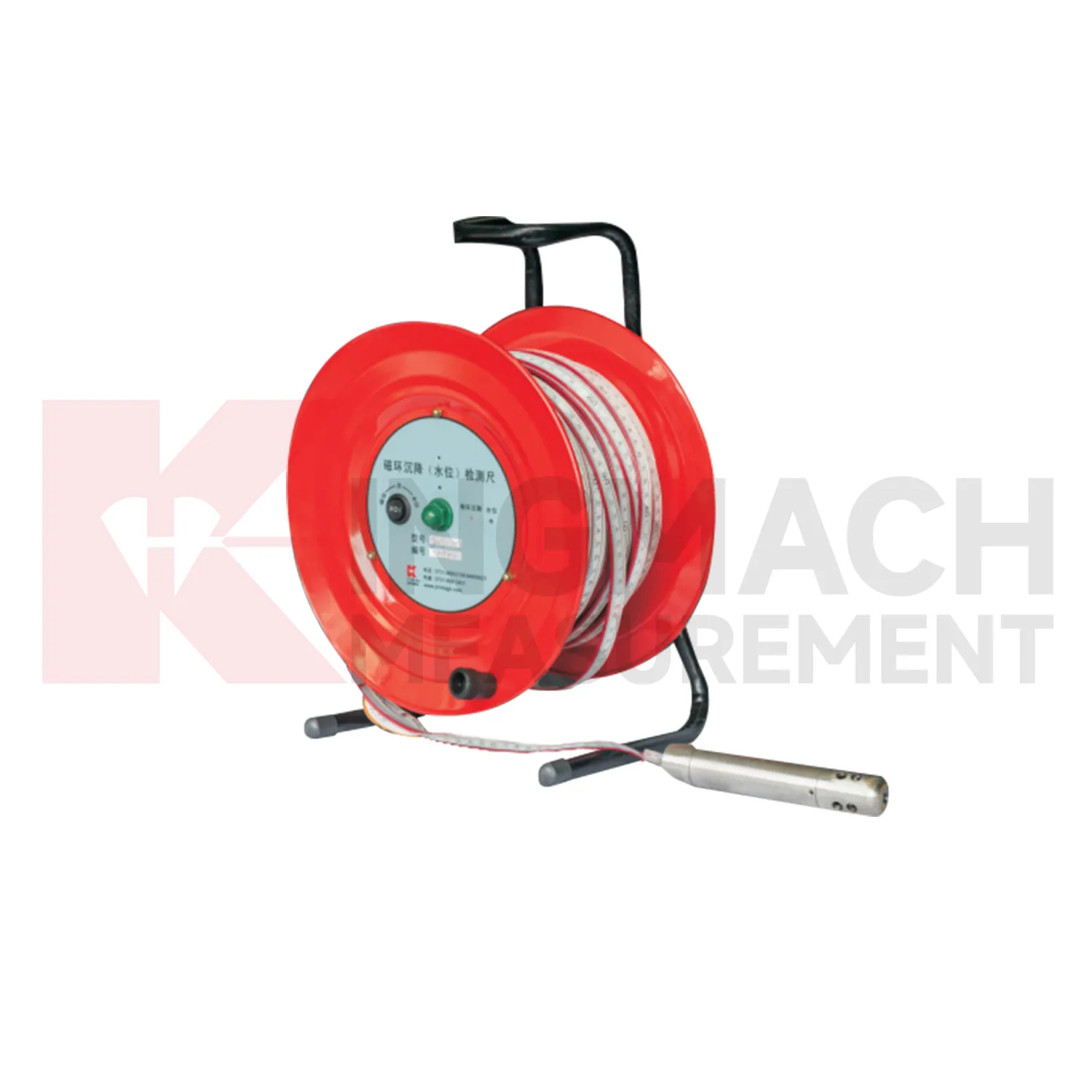
Q: How does magnetic ring settlement reading work?
A: Magnetic rings are placed underground; when the probe senses a ring, audible and visual alerts help the operator read depth from the steel tape at the borehole.
Q: How is water level detected?
A: The water level component works by water conductivity and alerts when the probe contacts water.
Q: What accuracy is listed?
A: The listed measurement accuracy is plus or minus 1 mm.
Q: What field records are needed?
A: Keep borehole number, magnetic ring depth, previous reading, current reading, groundwater level, and operator notes together.
Reviews
Robert Taylor
The weir flow meter is well-built and delivers accurate measurements. Great value for water management applications.
Ryan Lewis
Fast delivery and excellent product quality. The accelerometers and tiltmeters are highly reliable. Strongly recommend this company.
Latest Inquiries
To protect the privacy of our buyers, only public service email domains like Gmail, Yahoo, and MSN will be displayed. Additionally, only a limited portion of the inquiry content will be shown.
Harper***@gmail.comIndia
Dear Sir, we are planning to procure a complete monitoring system including strain gauges, tiltmeter...
Ava***@gmail.comAustralia
Hi, I am looking for reliable tiltmeters and accelerometers for structural health monitoring. Please...
Related product categories
- Wide-Range Differential Pressure Hydrostatic Level Sensor
- Inductive Frequency-Modulated Hydrostatic Level Sensor
- water level gauge
- water gauge water level gauge
- water gauge level
- gauge water level
- Magnetic Ring Settlement Water Level Gauge
- Optical Deflection Monitor
- Tilt Sensor
- Deflectometer
- Micro Range Hydrostatic Level Sensor
- Single-point Settlement Meter